The history of the land on which Hebble Wharf now stands is intrinsically linked to the history of the waterways that it served.
Historic photographs other information are reproduced courtesy of the Wakefield Libraries collection, Wakefield Historical Society and the Yorkshire Waterways Heritage Society.
Wakefield stands at the junction of two historic waterways – the Aire & Calder Navigation from Goole and the Calder & Hebble Navigation which continues westwards from Wakefield to Sowerby Bridge where it joins the Rochdale Canal. The two waterways were owned by separate canal companies and built to very different standards.
The growing coal and textile industries benefited from the arrival of cheap water transport on the Calder, upstream to Wakefield in c1702, upstream further from 1761, and making through connections into the industrial North West via the Huddersfield (opened 1811) and Rochdale (1804) canals, while the Barnsley Canal, opened in 1799, extended southwards from Wakefield too

The Aire & Calder Navigation linked Goole and Leeds, and comprised of a series of short canal sections with locks to by-pass shallow sections of the River Aire. From Castleford, a branch follows the River Calder upstream to Wakefield, and with the demand to carry more in bigger boats, locks almost 200 feet (61 metres) long were constructed to allow sea-going and coastal vessels, carrying 700 tons or more, to pass through. The Aire & Calder Navigation opened in stages from 1702 onwards.
…
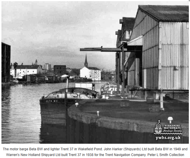
The Calder & Hebble Navigation continued westwards from Wakefield to Halifax and Sowerby Bridge, where it joined the Rochdale Canal taking barges across the Pennines and into Lancashire. Fully opened for navigation in 1770, the locks on the Calder & Hebble are among the shortest in the country at just 57’6″ (17.5 metres) long, meaning that goods arriving from the Aire & Calder had to be transhipped onto shorter barges to complete the journey to Manchester and beyond.
…
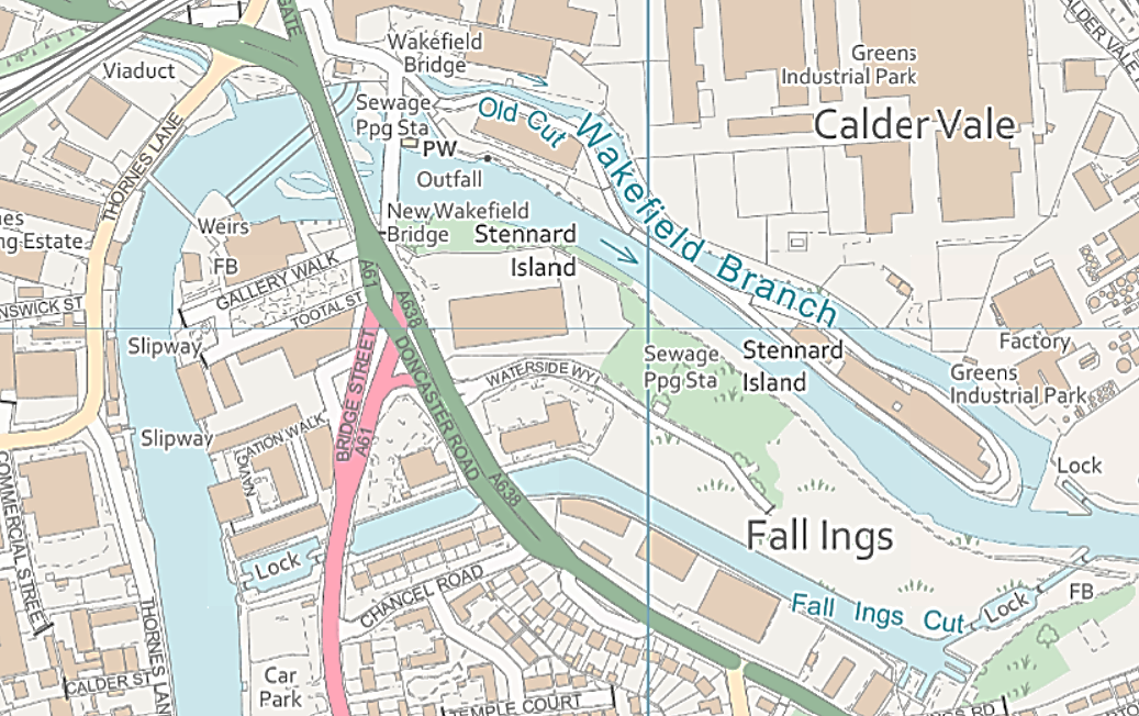
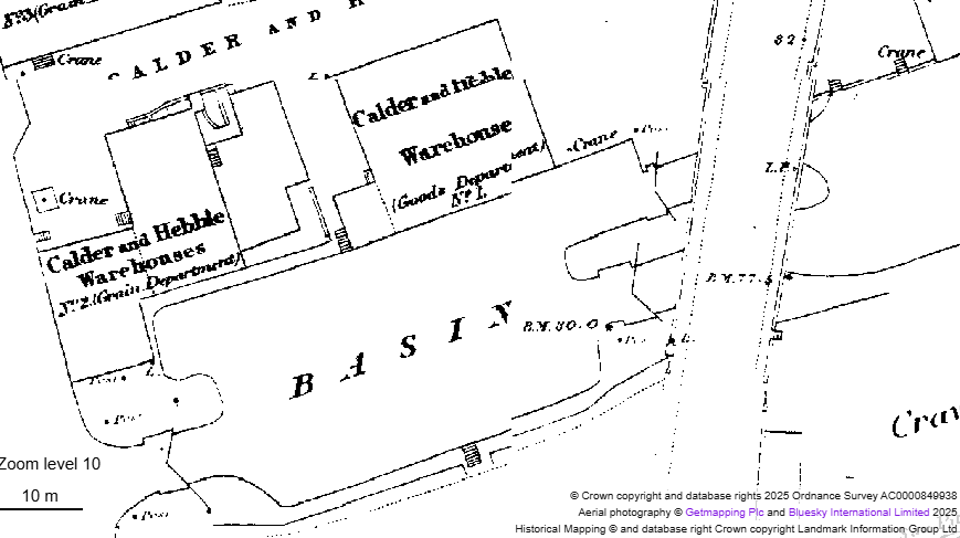
A critical link in the connection between these waterways is the Fall Ings Cut, a man-made channel leaving the River Calder at Fall Ings Lock and passing behind the timberyards on Doncaster Road before emerging back into the river above the weir at Wakefield Flood Lock, alongside Hebble Wharf.

Slide the < > button left or right to compare the images
These images compare Wakefield in 1905 and 2025, showing the line of Fall Ings Cut belonging to the Calder & Hebble Navigation Company. which largely made redundant the old cut of the Aire & Calder Navigation to the north of the river, terminating at Wakefield Wharf, close to the Chantry Bridge. Note that Chantry Bridge was then known as Wakefield Bridge and was the only river crossing until the new Wakefield Bridge was opened in 1953.
Serving Wakefield and beyond by canal and river
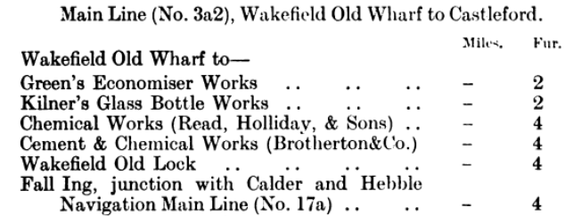
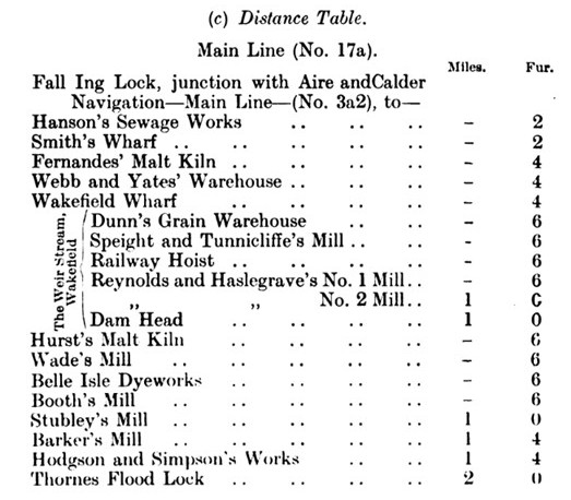
As this extract from Bradshaw’s 1904 Guide to Canals & Rivers describes, the Calder & Hebble Navigation between Fall Ings Lock and Thornes Lock served a variety of wharves, mills, malt kilns and other businesses – including a railway hoist (directly opposite where the Hepworth Wakefield stands now) – where coal would be tipped directly from railway wagons into barges. Mills listed along the Weir Stream faced the river between the Flood Lock and the weir. More businesses were served by the Aire & Calder Old Cut leading to Wakefield Old Wharf:
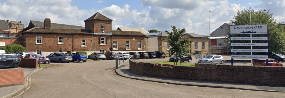
Wakefield Old Wharf, at the end of the Old Cut, was where the Aire & Calder Navigation company established its headquarters in a building that can still be seen today in the business centre known as Navigation Yard.
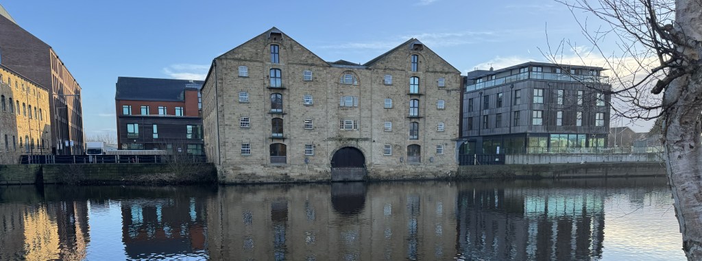
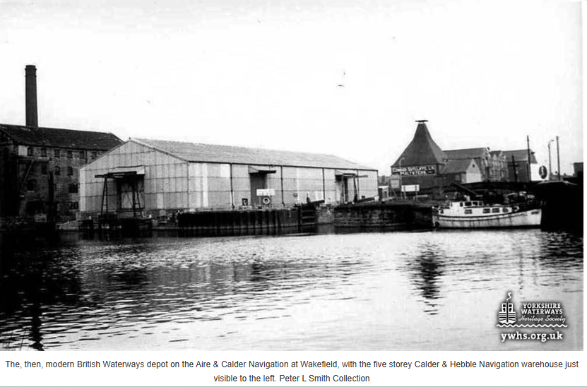
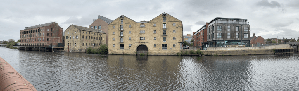
…The process of unloading cargo from one barge and loading it onto another took place at Wakefield Wharf on the River Calder, alongside the Navigation Warehouse. This was the impressive headquarters of the Calder & Hebble Navigation Company, built four storeys high with a loading dock in the centre. The Navigation Warehouse has been substantially restored and stands alongside Hebble Wharf.
…
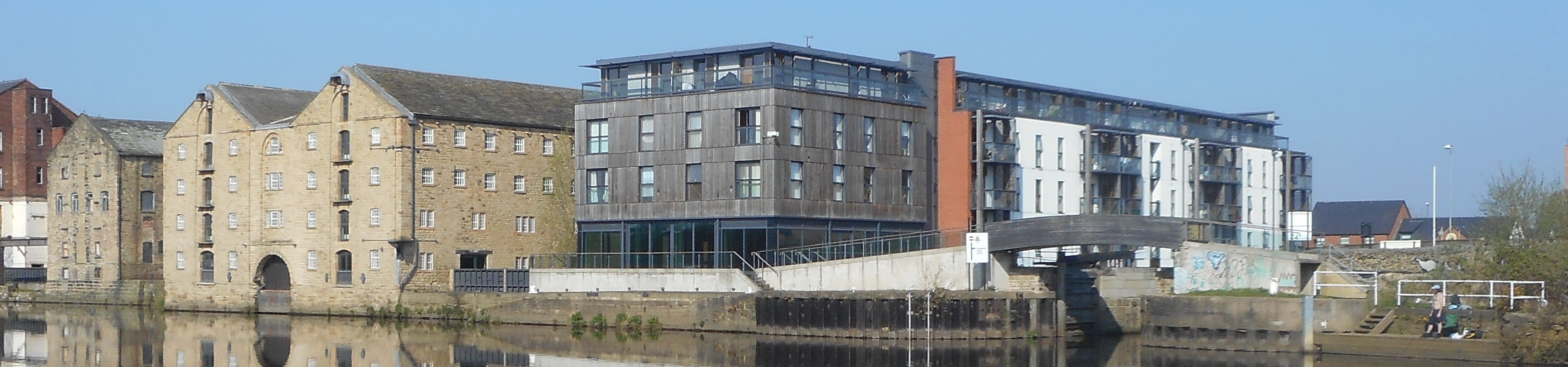
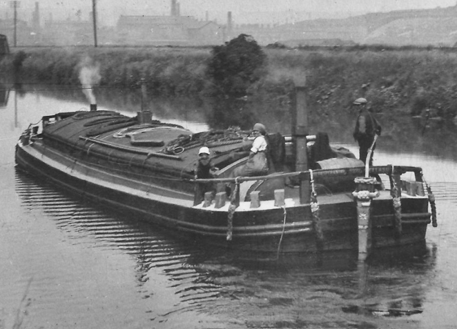
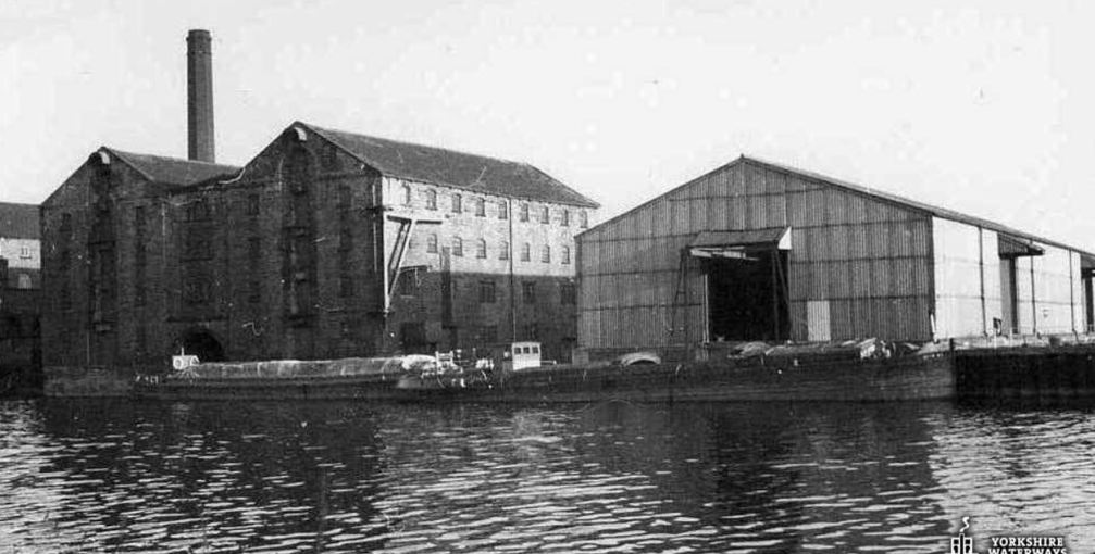
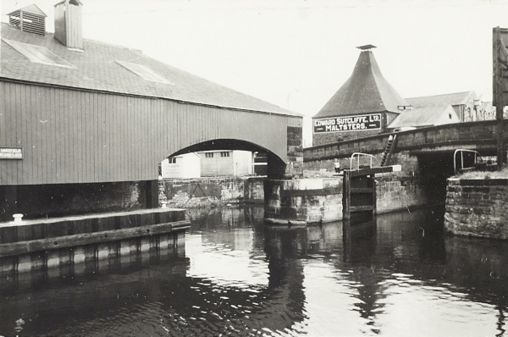
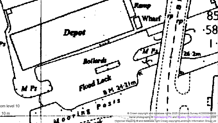
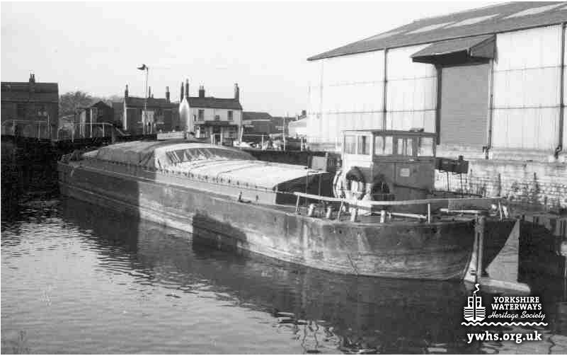
Hebble Wharf was built between 2006-2008 on the site of another major canal warehouse – this one owned by the Aire & Calder Navigation Company – and in the heyday of canal traffic, long barges from the Aire & Calder would dock here to offload cargo for transfer to the shorter Calder & Hebble barges, as can be seen in the picture below. The iron mooring bollards for these barges are still in place today.
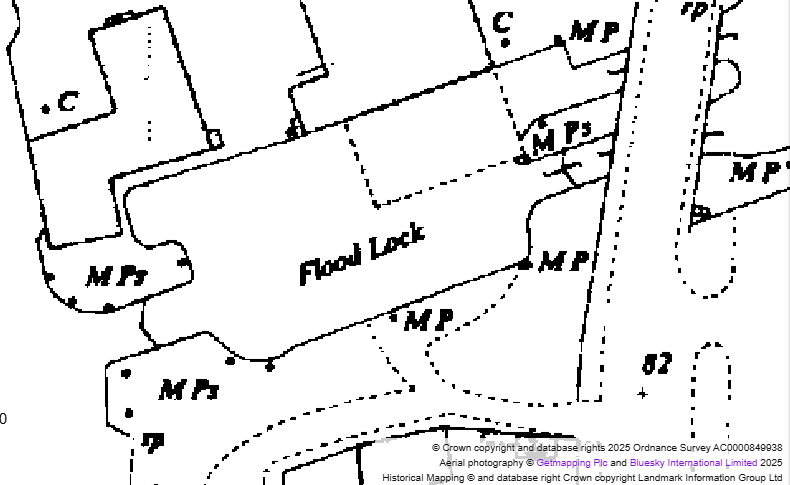
This map dating from 1851 clearly shows that there were originally two separate locks under Barnsley Road bridge, separated by an island supporting the road bridge.
…
Just beyond Barnsley Road bridge were the Sutcliffe’s malt kilns – later to become the London & North Western Canal Warehouses.
By 1890, the Aire & Calder Navigation Company had constructed a canopy across part of the Flood Lock to create a covered dock, supported by a stone column on the end of the island (still visible today) a sunken pilings in the centre of the flood lock, as shown on this map dating from 1891.
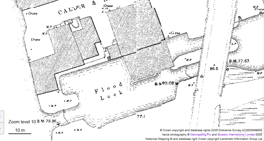
1950s mapping still shows the outline of the covered dock as well as the second channel under Barnsley Road bridge – though the map is less clear on whether the second set of lock gates still existed.
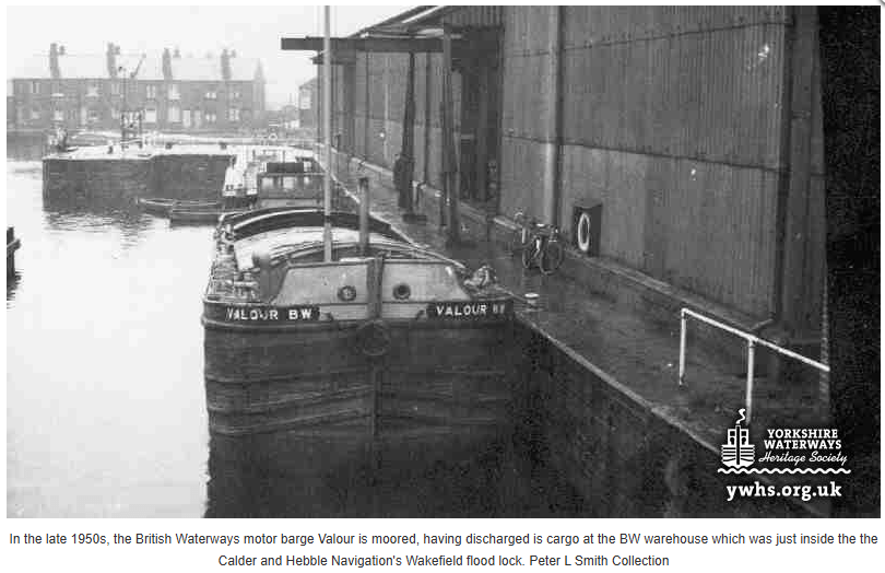
During the 1950s, the canopy over the covered dock was dismantled, leaving the in place t additional mooring, still visible in the following photograph taken in 1959 showing the British Waterways barge Valour moored in the space that would previously have been covered.

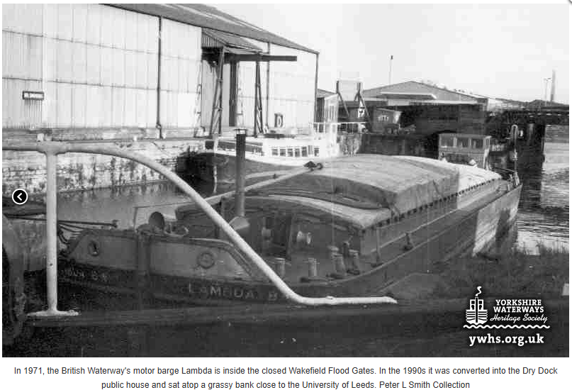
These photographs taken in 1971 show the BW Barge Lambda still using the mid-lock mooring bollards while waiting to pass through the flood gates onto the River Calder.
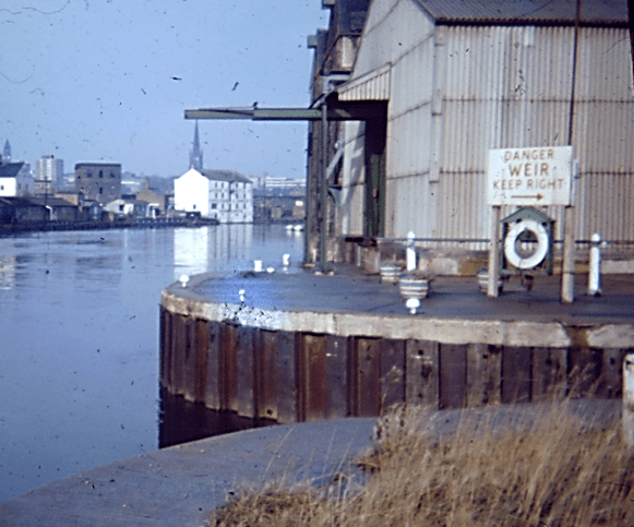
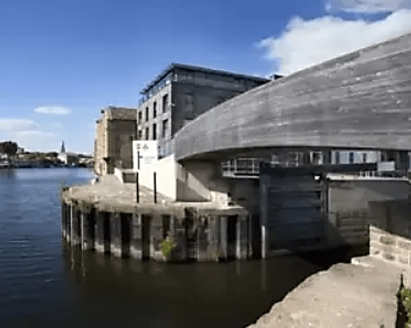
In the images below, we see the Aire & Calder warehouse at the entrance to Wakefield Flood Lock, alongside a picture taken at the same location today.
…
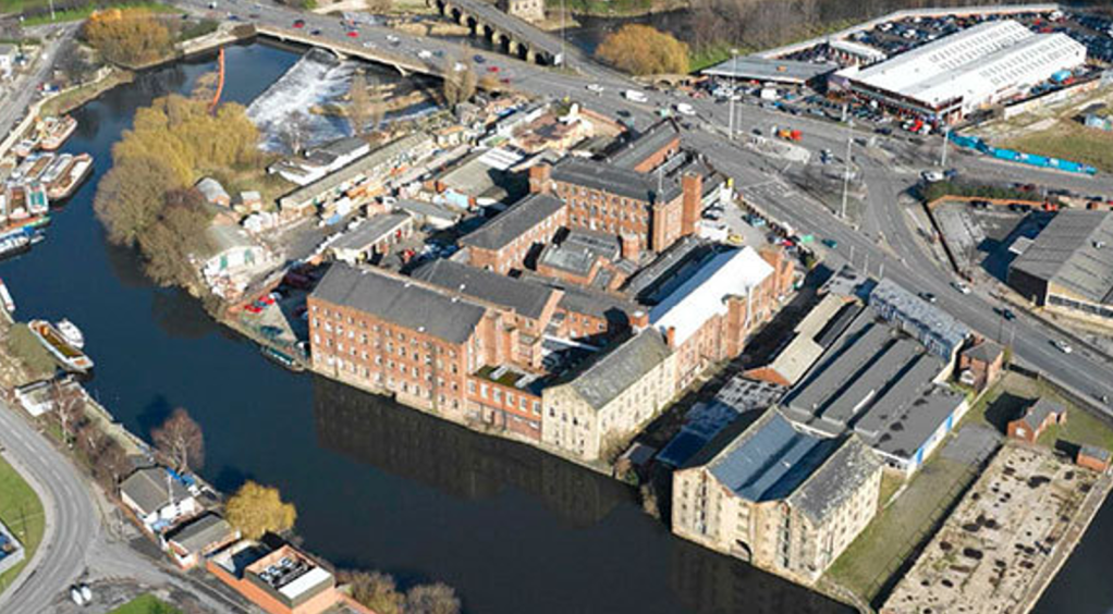
This aerial image shows the site on which Hebble Wharf was to be built in the bottom right corner, after the Aire & Calder warehouse had been demolished. Note the many warehouses and small buildings that covered the areas now occupied by the Hepworth Gallery (opened in 2011), Rutland Mills and the new office buildings around Navigation Walk.
…
Here you can see the entrance to Wakefield Flood Lock at around the same time, before construction started on Hebble Wharf.
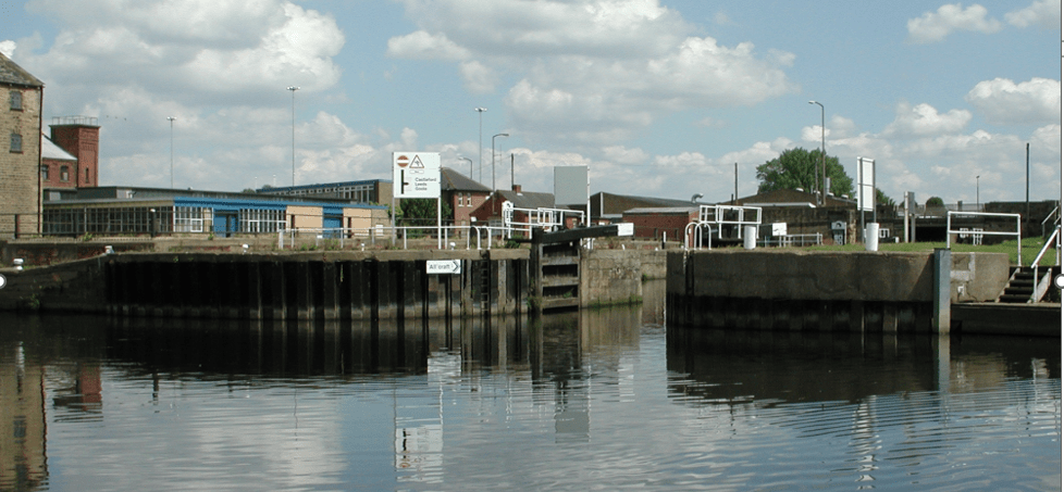
Why is the Flood Lock there?
Flood Locks were built along the Calder and Hebble Navigation from Wakefield up to Brighouse to protect the canalised sections of the Navigation from the effects of the frequent floods that occur along the River Calder. Floods destroyed some of the canal before it even opened in the 1760s and have continued to restrict navigation on the river sections most years.
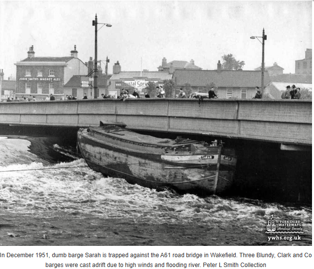
The power of the floodwater can be seen in the following photographs – the first dating from 1951 and the second from December 2015, both showing barges that had been swept away from the boatyard above Wakefield Bridge and become trapped either on the Weir or under the bridge itself.
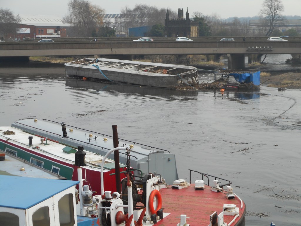
…
